About this app
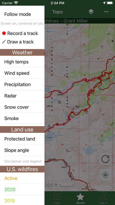
Bring the mountains with you wherever you go! * Search the huge database of mountains and trip reports from Peakbagger.com and ListsOfJohn.com * Keep track of your climbs, even when offline * Measure your progress against hundreds of peak lists * Get route information and directions from SummitPost and ListsofJohn.com * Find peaks near your current location, or near other peaks * Filter peaks by prominence, or climbed vs. unclimbed, or inclusion on a peak list * See what other peaks are often climbed together with your target peak * Create custom peak lists and order them by your personal priorities * See weather forecasts for all U.S. peaks from the National Weather Service, and for 11,000+ major peaks worldwide from mountain-forecast.com * See topographic maps for anywhere in the world (+/- 60 degrees latitude) * See protected land area coverage in North America, Europe, Japan, and Australia and New Zealand * US Forest Service maps * Save a peak to your device for offline use, including topographic maps * Download topographic maps along a route for offline use * Import and display GPS tracks and waypoints instantly * On-screen compass keeps you oriented along your track * Long click on the map to get Street View, elevation, and driving directions * Record your starting elevation, distance, and information about the gear and route you used * Leaderboards show the top climbers for each peak list * See peaks your Peakbagger buddies have climbed recently * Update your buddy list from right in the app * Automatically upload your ascents to ListsOfJohn (U.S. peaks) * Show daily satellite imagery for any location on any day since 2011 * Display elevation profile for a GPS track, and show your current location along the profile * See sunrise and sunset times at a peak, even when offline * Daily forest fire coverage, and historical coverage for the last 20 years (U.S.) * Constantly updated weather radar and smoke layers on the map * Record GPS tracks, including timestamps, and add them to your ascents * Record waypoints along your route * Organize your tracks in folders * Create and edit tracks right in the app * Automatically find survey benchmarks near peaks (U.S.) * Hunt benchmarks and get your finds recorded in the official government benchmark data sheets HOW TO IMPORT GPS TRACKS - 2 OPTIONS 1) Click on the "Load GPS track" link on the ascent details page for an ascent that has a GPS track. 2) Click on a GPX, KML, KMZ, TCX or FIT file on your phone, for example, in an email attachment or on Google Drive
Latest release
What’s New
- Topo maps for Trinidad, Saint Lucia, Saint Vincent, Sicily, Sardinia, Campania - Show alternative high points for a peak on More page - Add 2026 fires - Update offline peak databases
Audience growth
Ratings growth
Baseline captured. Growth appears after the crawler observes a changed rating count.
Momentum comes from crawler snapshots for the tracked storefront. “Viral growth signal” means unusually fast recent rating gains; it is an indicator, not download data.
Price tracking
Price intelligence
First snapshot captured. The trend line starts after the next crawler price observation.
- First observed Aug 20, 2026 · 10:48 PM Free
Screenshots