About this app
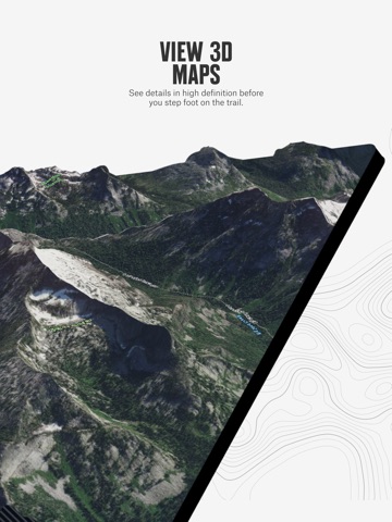
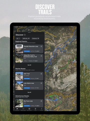
Scout new terrain and navigate in-field maps with the most comprehensive, intuitive four-season backcountry App. Trusted by guides and heralded by pros, onX Backcountry features 650,000+ miles of hiking and biking trails, 300,000+ rock climbs, and 4,000+ ski routes. With interactive 3D Offline Maps, easy-to-use GPS navigation, and trustworthy mapping data, onX Backcountry gives you the tools to execute incredible outdoor adventures. Plan hiking, mountain biking, backpacking, or skiing trips with clarity on terrain, slope angle, and conditions. Switch between activity-specific Map Modes. Toggle Map Layers to show nearby hazards such as wildfires or avalanche terrain. Study distance and elevation gain, locate free dispersed camping, and sync your map across devices before you even leave the house. Map out custom routes with our snap-to-trail feature and add Waypoints to points of interest. Review Slope Angle and Slope Aspect to evaluate the steepness and direction of terrain. View localized Weather, hour-by-hour Wind Forecasts, and Recent Satellite Imagery. Download 3D Offline Maps so you can find your way back to camp, even without cell service. Leave a breadcrumb trail with Tracker to measure key trip stats. A great day starts with a better map. Go farther today with onX Backcountry. onX Backcountry Features: ▶ Does onX Backcountry work without cell service? onX Backcountry is built for remote, offline GPS navigation. Download 3D Offline Maps and access interactive trail and Map Layer data. Navigate off-grid trails with confidence, see exactly where you are on satellite imagery, and track activity stats even without signal. ▶ How can I find and track backcountry hiking trails? Discover guidebook hiking trails or build custom routes based on key terrain features. Use route builder to plan backpacking trips with realistic expectations of time, distance, and elevation. Hike responsibly by checking private land, dispersed camping, active fire, and terrain Map Layers. ▶ What mountain biking trails and features are available? Plan your next ride with detailed information on trail difficulty, elevation, and distance. Build your own MTB route or access thousands of expert-sourced trails. Download interactive maps for offline use and understand complex terrain using LiDAR Topo, Satellite, and Terrain Basemaps. ▶ How can I plan rock climbs and backcountry ski tours? Find new climbs powered by Mountain Project and analyze your approach in 3D. View recent Snow Imagery, Beacon Guidebook routes, real-time Weather Forecasts, and Avalanche Simulator data. Evaluate slope risk with Avalanche Terrain Exposure Scale (ATES) maps. ▶ How does onX Backcountry deliver better in-field maps? onX Backcountry is the only App with offline 3D, LiDAR-based Topo, intuitive route building, and proprietary Map Layers for conditions, cell coverage, and terrain. With four-season outdoor coverage and US-based customer support, access the most detailed maps for the backcountry. ▶ Premium & Elite Membership • 650,000+ miles of hiking, backpacking, and mountain bike trails • 4,000+ backcountry skiing lines with guidebook descriptions • 300,000+ rock climbing routes with approach trails • 3D Offline Trail Maps to navigate without cell service • 985 million acres of Public Land across the U.S. • 550,000 Recreation Icons: Trailheads, backcountry cabins, campgrounds, and more • Map data sourced from USFS, BLM, and NPS • Private Land Layer (ELITE ONLY) • Recent Satellite Imagery (ELITE ONLY) ▶ onX SOS: When something goes wrong in the field, onX SOS connects you to a 24/7 professional rescue team that coordinates help and covers rescue and evacuation costs. • Available as an add-on subscription for $49.99/year • Powered by Overwatch x Rescue (OxR) ▶ Terms of Use: https://www.onxmaps.com/tou ▶ Privacy Policy: https://www.onxmaps.com/privacy-policy ▶ Feedback: Please contact us at support@onxmaps.com. We’d love to hear from you.
Latest release
What’s New
We improved user experience with a few bug fixes as well as preparing the app for future feature updates.
Audience growth
Ratings growth
Momentum comes from crawler snapshots for the tracked storefront. “Viral growth signal” means unusually fast recent rating gains; it is an indicator, not download data.
Price tracking
Price intelligence
- First observed Aug 16, 2026 · 10:40 AM Free
Screenshots