About this app
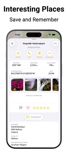
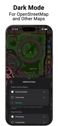
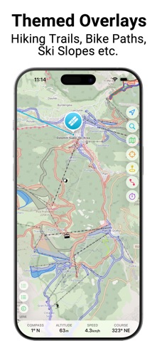
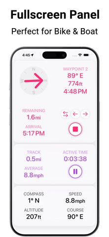
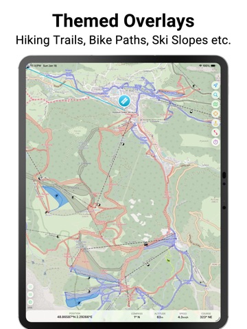
Professional navigation that respects your privacy. Mapki combines precise GPS tools and versatile maps in one app that works entirely without accounts – no registration required. Your data stays where it belongs: locally on your device or securely synced via your private iCloud. For all outdoor enthusiasts: - Hikers & Alpinists: Use detailed maps, plan tours with elevation profiles, and stay informed in remote areas thanks to offline caching. - Cyclists & Mountain Bikers: Benefit from specialized cycling overlays and smart routing tailored for your journeys. - Sailors & Skippers: Nautical units, OpenSeaMap and Man Overboard (MOB) button for safety on the water. - Athletes & Fitness Fans: Record your activities via GPS tracking and save them as workouts in Apple Health, complete with calorie calculation. - Explorers & World Travelers: Plan your next destinations, save special places with photos and notes, and capture your favorite memories along the way. - GIS Experts & Professionals: Full support for UTM and MGRS coordinates, GPX-Import/Export, plus integration of custom WMTS/WMS map servers for maximum flexibility. Free Features: - Maps: Apple Maps, OpenStreetMap, and Public Transport map. - Overlays: Specialized layers for hiking, cycling, skiing, and water sports. - Offline Use: Caching of preinstalled tile-based maps and overlays. - Route Planning: Add and edit waypoints. - Navigation: Find your way along waypoints. - Tracking: Record and analyze your outdoor activities. - POIs: Search and save places, coordinates, addresses, etc. - Content: Add photos and notes to places, routes and tracks. - Sorting and Filtering: By rating, favorites, color flags & more. - Measuring: Crosshair tool to measure distance and bearing. - Units: Support for metric, US, and nautical units. - Formats: Various coordinate representations including UTM and MGRS. - More Features: GPS accuracy display, GPX import, dark mode for tile-based maps. - User-Friendly: Colors assigned to functional areas help navigating the app. Additional PRO Features: - Custom Maps: Integrate any WMTS and WMS map tile server. - Custom Overlays: Add weather maps, drone no-fly zones or terrain reliefs etc. - Offline Use: Caching of all custom maps, overlays and reliefs. - Elevation: Altitude data for places and profiles for planned routes. - Smart Routing: Automatic routing for walking & hiking, cycling, or motorcycling & driving. - Advanced Navigation: Guidance along calculated routes. - Post-Processing: Trimming of GPS tracks. - Grouping: Combine places into lists and routes/tracks into multi-stage tours - Organization: Sort places, routes and tracks into collections. - Apple Health Integration: Save activities as workouts to Apple Health. - Connectivity: Export places, routes and tracks as GPX files. - Fullscreen Dashboard: High-visibility display of all critical real-time values. - Nautical Safety: Dedicated Man Overboard (MOB) button. The full-featured PRO version can be unlocked at any time within the app. The standard Apple Terms of Use apply: https://www.apple.com/legal/internet-services/itunes/dev/stdeula/
Latest release
What’s New
Introducing a new way to group saved items in the PRO version: Place lists, multi-stage routes, and multi-stage tracks, i.e. list with multiple places as well as routes and tracks with multiple stages. Also: - Improved settings menu for better clarity. - Place markers can be displayed in their flag color. - Tap on "Altitude" shows current vertical speed. - OpenTopoMap removed from preinstalled maps to reduce load on their servers. However, it can be added manually in the PRO version. - General bug fixes and improvements.
Audience growth
Ratings growth
Baseline captured. Growth appears after the crawler observes a changed rating count.
Momentum comes from crawler snapshots for the tracked storefront. “Viral growth signal” means unusually fast recent rating gains; it is an indicator, not download data.
Price tracking
Price intelligence
First snapshot captured. The trend line starts after the next crawler price observation.
- First observed Aug 19, 2026 · 11:46 PM Free
Screenshots