About this app
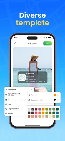
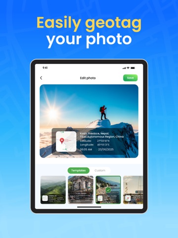
GPS Map Cam: Photo Location Tag every photo with precision. Capture moments that tell the full story. Capture photos with accurate GPS coordinates embedded. The app automatically detects your current location and saves it to each photo as you take it. Whether you’re traveling, exploring nature, or documenting your work, you’ll always know exactly where each photo was taken. Record videos with real-time GPS tagging. Location data is embedded directly into the video file while you film. Ideal for travel vlogs, outdoor adventures, or professional use where exact location reference is important. Customize your media with detailed GPS templates. Choose from various overlay styles to show date, time, latitude, longitude, and more. Your photos become both informative and visually unique, blending style with context. Edit location and time data anytime. You can manually change GPS coordinates, date, or timestamp for any saved photo or video. Gain full control over your memories and ensure every detail is accurate. Browse your photos and videos in a clean, organized gallery. Use the built-in map view to explore your media by location or filter by time and place. Rediscover your past experiences in the most intuitive and meaningful way. Add context and clarity to your memories. Download GPS Map Cam: Photo Location and start capturing your world with location-based precision.
Latest release
What’s New
Fix current location determination error, Optimize display of available templates
Audience growth
Ratings growth
Baseline captured. Growth appears after the crawler observes a changed rating count.
Momentum comes from crawler snapshots for the tracked storefront. “Viral growth signal” means unusually fast recent rating gains; it is an indicator, not download data.
Price tracking
Price intelligence
First snapshot captured. The trend line starts after the next crawler price observation.
- First observed Aug 6, 2026 · 3:21 PM Free
Screenshots