About this app
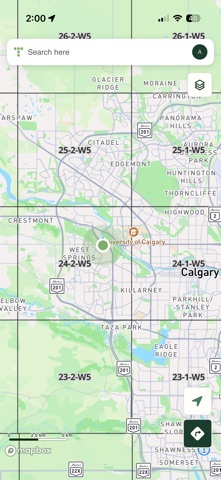
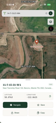
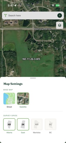
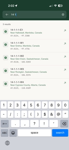
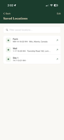
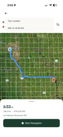
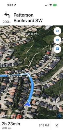
Township Canada is the go-to app for professionals who work with legal land in Western Canada — find any parcel, and everything on it. Trusted since 2017 by thousands of surveyors, oil & gas workers, and agricultural consultants. Search by legal description, GPS coordinates, or place name to instantly locate any parcel. Get turn-by-turn directions to remote sites. View precise survey grids overlaid on satellite and street maps. Open detailed parcel reports with soil, crop, well, and pipeline data. Save your most-visited parcels for quick access. FEATURES • Search by Legal Description, Coordinates, or Place Name Locate any parcel using DLS notation like NE-14-24-4-W5M or NTS references for British Columbia. Search by GPS coordinates or place names when you need flexibility. Peace River parcels in BC show both their DLS and NTS references. • Turn-by-Turn Navigation Get directions to any land parcel. No street address needed. Navigate directly to remote locations for field work, site visits, and inspections. • Precise Grid Overlays View township, range, section, quarter-section, and legal subdivision boundaries. BC users get full NTS series, block, unit, and quarter-unit overlays. All grids are vector-based for crisp rendering at any zoom level. • Save Favourite Locations Bookmark frequently accessed parcels for instant recall. Ideal for ongoing projects and repeat site visits. • Professional Map Views Switch between Street and Satellite views. Both support full DLS/NTS grid overlays for complete situational awareness. PARCEL REPORTS Tap any parcel to open a report. Two optional data bundles take you beyond the boundary line: • Agriculture Soil order, texture, drainage, and slope. LSRS productivity scores, Land Capability (CLI) classes, five-year crop rotation history, drought severity, and wetlands — plus an Agriculture map overlay. Sourced from AAFC, AGRASID, CLI, ABMI, and the Canadian Drought Monitor. • Energy Wells with licence status and fluid type, trailing-12-month production, pipeline crossings with substance and H₂S level, facilities, operator breakdowns, and Crown mineral tenure — plus an Energy map overlay with status-coded wells. Sourced from the AER, OWA, Petrinex, and Alberta Crown tenure. COVERAGE Alberta: Full DLS grid (townships, sections, quarters, LSDs) Saskatchewan: Full DLS grid Manitoba: Full DLS grid and River Lots British Columbia: Full DLS and NTS grids (series, blocks, units, quarter-units) Energy & Agriculture map layers: all four provinces WHO IT'S FOR • Surveyors and geomatics professionals • Landmen and land agents • Oil and gas field workers • Agricultural consultants and farm managers • Real estate professionals • Forestry and natural resource managers • Anyone working with legal land in Western Canada SUBSCRIPTION Township Canada requires a license key. Subscriptions are available monthly or annually at townshipcanada.com, with optional Agriculture and Energy data bundles. One license works on one device at a time; deactivate and transfer between devices as needed. PRIVACY No analytics tracking. No ads. Your search history and saved locations stay on your device. See our full privacy policy at https://www.townshipcanada.com/privacy-policy. SUPPORT Questions or feedback? Email hello@townshipcanada.com or visit townshipcanada.com.
Latest release
What’s New
Sign in with your account, no more license keys • Sign in with your Township Canada account: email code, Google, or Microsoft • The app is now included with every paid plan, nothing separate to buy • One active device per account: sign in on a new device and the previous one signs out automatically • Stability and performance improvements Questions? hello@townshipcanada.com
Audience growth
Ratings growth
Baseline captured. Growth appears after the crawler observes a changed rating count.
Momentum comes from crawler snapshots for the tracked storefront. “Viral growth signal” means unusually fast recent rating gains; it is an indicator, not download data.
Price tracking
Price intelligence
First snapshot captured. The trend line starts after the next crawler price observation.
- First observed Aug 19, 2026 · 5:30 AM Free
Screenshots