About this app
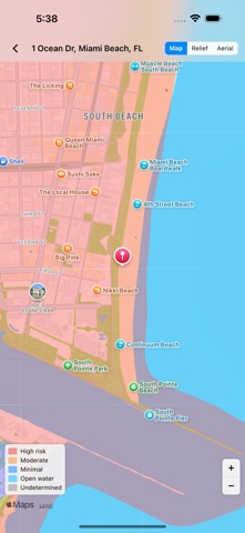
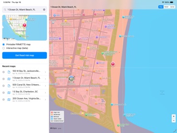
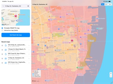
Flood Risk Map Maker displays a map that shows the flood-prone areas near a given street address in the United States. Identify flood zones to watch out for after a rainstorm, tropical storm, or hurricane. To use: - Type your street address - Tap "Get Flood Risk Map" Depending on the availability of the flood study data in your area, this app will generate one of the following results: - Areas with modern digital FEMA flood study data: A printable PDF showing about 400 acres or about 0.6 sq. mi. - Areas with old FEMA flood study data: A scanned image of an older printed map - Remote areas where a FEMA flood study has not been conducted: No map available - Interactive map (beta): Pan and zoom a live map with color-coded flood zone overlays Ideal for: - Homeowners and home buyers - Real estate agents - Farmers - Insurance professionals - Businesspeople - Anyone doing a risk assessment or asking "Am I in a flood zone?" Ad-supported. If you like the app, please consider upgrading to remove the ads and support future development.
Latest release
What’s New
Behind-the-scenes changes to keep things running smoothly.
Audience growth
Ratings growth
Baseline captured. Growth appears after the crawler observes a changed rating count.
Momentum comes from crawler snapshots for the tracked storefront. “Viral growth signal” means unusually fast recent rating gains; it is an indicator, not download data.
Price tracking
Price intelligence
First snapshot captured. The trend line starts after the next crawler price observation.
- First observed Aug 12, 2026 · 1:55 AM Free
Screenshots