About this app
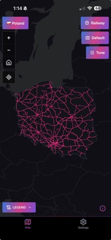
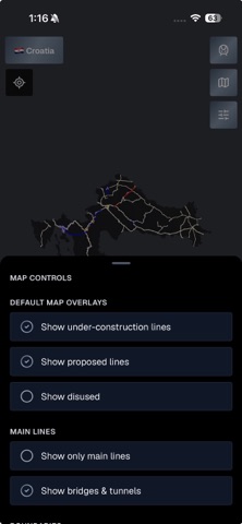
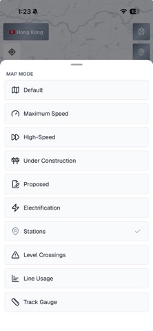
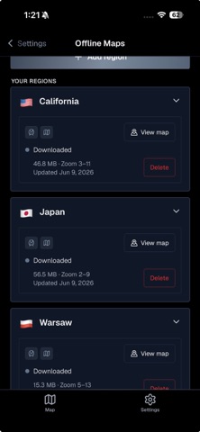
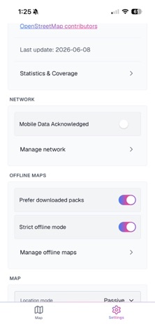
RailsMaps is built around regions — pick one, then explore the railway network the way you want. Vector maps load fast, zoom deep, and stay sharp. Also on web: railsmaps.com Rail types • Mainline railways, metro, tram, light rail, narrow gauge, monorail, funicular, miniature railways Map modes (availability varies by region and rail type) • Standard: full network with rail type colouring • Max speed: lines by permitted speed • Electrification: AC and DC systems by voltage • Track gauge: standard, broad, narrow, mixed • Usage: passenger, freight, heritage, industrial • High-speed: dedicated HSR and fast corridors • Stations: station and halt locations • Level crossings: classified by safety • Under construction and proposed lines • Historical: disused and abandoned railways Offline maps • Download region packs for full offline map access • Region packs updated weekly • Tile depth scales with region size: city packs reach zoom 13, national packs zoom 9 — range shown before download • Strict offline mode: block network requests, use installed packs only • Wi-Fi-only downloads and per-region disk usage control Map customization • Built-in presets: default and infrastructure-style colouring • Custom presets: adjust rail line colors, widths and visibility per layer state • Up to 20 presets saved on device, applied separately for light and dark themes Layers and appearance • Vector basemaps (auto, light, dark) with optional raster overlay • Rail layer opacity, basemap labels on/off • Country and city boundary overlays • Compare two regions side by side • Light, dark, or follow the system theme Line & station details • Tap any line or station for speed, gauge, electrification, usage and Wikipedia data Location • Optional passive or active location — see where you are on the rail network • Follow mode to track movement along any line — useful on heritage railways and historical routes Web Export Pass • One-time free claim: +2 weeks of web export access on railsmaps.com and freakmaps.com • Custom styles, region clipping and watermark-free PNG export in your browser Coverage • 650+ regions: countries, states, provinces and major urban areas • 13 interface languages Data from OpenStreetMap contributors. Coverage and attribute completeness vary by region.
Latest release
What’s New
• Web Export Pass: redeem with an email sign-in code — as well as magic link or Google/Apple • Maintenance and stability improvements
Audience growth
Ratings growth
Baseline captured. Growth appears after the crawler observes a changed rating count.
Momentum comes from crawler snapshots for the tracked storefront. “Viral growth signal” means unusually fast recent rating gains; it is an indicator, not download data.
Price tracking
Price intelligence
First snapshot captured. The trend line starts after the next crawler price observation.
- First observed Aug 23, 2026 · 6:09 AM $4.99
Screenshots