About this app
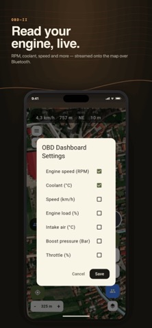
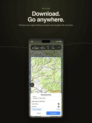
DirtMap is offroad navigation built for the trail, not the highway. Offline topographic and satellite maps, turn-by-turn offroad GPS navigation, GPX route planning, live convoy tracking with voice messages and SOS, and a full rally/competition engine — one rugged app for 4x4, overlanding, enduro and ATV. OFFLINE MAPS & TERRAIN • Topographic, satellite and OpenStreetMap layers with 3D terrain and hillshade • Download whole regions at home, then navigate with zero signal • Trail-difficulty overlay and offroad POIs (camping, water, fuel, viewpoints) OFFROAD TURN-BY-TURN NAVIGATION • Plan 4x4 routes point by point, or import any GPX track • Navigation and off-track alerts on dirt roads and forest tracks TRACK RECORDING + GPX • Record GPS tracks in the background with the screen off • Import and export GPX — your routes are always yours • Turn a trail day into a shareable map-flyby trip video LIVE CONVOY TRACKING • See every vehicle's live position on the map and follow the leader's trail • Push-to-talk voice messages to the whole group — no phone calls, works over Android Auto • SOS alert with position for emergencies • Friends join with a link or QR code — no account needed OFFROAD RALLY & COMPETITION ENGINE • Organize club runs, treasure hunts and offroad competitions with checkpoints • Live scoring, leaderboards, vehicle categories, TSD stages, no-go zones and penalties • Works fully offline on race day and syncs when signal returns — engineered for events with 100+ vehicles • Your first event is free VEHICLE & OBD-II • Live gauges from a Bluetooth OBD-II adapter: speed, RPM, coolant, battery, fault codes • Service, insurance and inspection reminders AND MORE • AR peak finder: point your camera at the horizon and name the mountains • Live rain radar and weather alerts • Area survey: walk a boundary, get m²/hectares • Try everything without creating an account (guest mode) Free to start — offline maps, route planning, track recording and GPX are included. Premium unlocks unlimited convoys, offline areas and cloud routes, with a 14-day free trial.
Latest release
What’s New
• Contour lines, hillshade and offline 3D terrain • Automatic switching: lose signal and the offline map takes over; back online, your chosen layer returns.
Audience growth
Ratings growth
Baseline captured. Growth appears after the crawler observes a changed rating count.
Momentum comes from crawler snapshots for the tracked storefront. “Viral growth signal” means unusually fast recent rating gains; it is an indicator, not download data.
Price tracking
Price intelligence
First snapshot captured. The trend line starts after the next crawler price observation.
- First observed Aug 20, 2026 · 1:47 AM Free
Screenshots