About this app
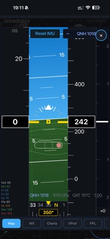
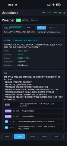
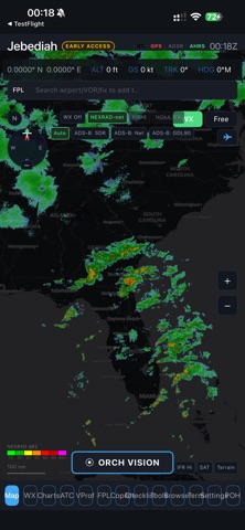
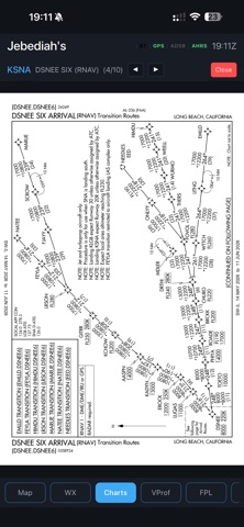
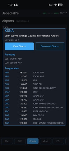
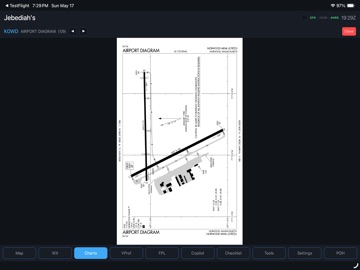
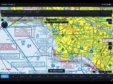
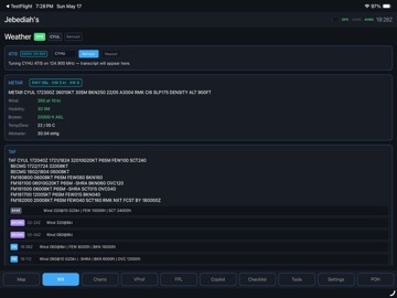
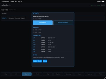
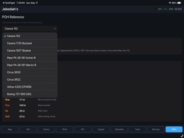
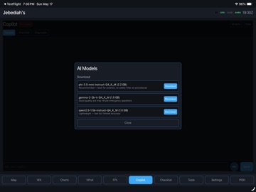
Jeb's Flight Bag is a next-generation Electronic Flight Bag built for pilots who want a serious cockpit toolkit without the lock-in of subscription-only iPad apps. WHAT YOU GET • Moving map with FAA VFR Sectional, IFR Low, IFR High, satellite, and dark-mode tile layers — pinch-to-zoom on the tablet, scroll-wheel on the desktop. • Live ADS-B traffic via Sentry, Stratux, Stratus, Garmin GDL, uAvionix SkyEcho — anything that broadcasts GDL90 over WiFi. • Real WAAS GPS from your portable receiver — even on a WiFi-only iPad with no internal GPS chip. • NEXRAD weather radar over the US (Iowa State Mesonet, sub-km, ~2 min refresh) and RainViewer worldwide composite outside CONUS. • FAA d-TPP approach plates with georeferenced ownship overlay — the aircraft chevron moves on the plate at the right pixel position as you fly. • METAR / TAF / NOTAMs / SIGMETs / PIREPs / TFRs / winds aloft, with color-coded VFR / MVFR / IFR / LIFR flight category dots at every airport on the map. • Two-finger touch ruler — measure nm + bearing between any two points. • Synthetic-vision PFD-style attitude indicator from your device's IMU. The rotation-vector sensor is fused even on tablets without a gyroscope. • ATC frequency reference, nearest airports / navaids / fixes, ICAO route export, ForeFlight-style auto-routing with SID/STAR insertion. • Pilot's Operating Handbook reference — Cessna 152, 172, 182, Piper PA-28, Cirrus SR22, plus PDF upload that uses Claude AI to extract V-speeds, weights, fuel, and performance numbers from any aircraft's POH. • Performance calculator: density altitude, takeoff / landing distance with weight, headwind, and POH baseline corrections. • On-device LLM copilot — answers flight-planning questions, decodes METAR-ese, walks emergency checklists. Routes to Anthropic's Claude API when an API key is configured, falls back to bundled MLC LLM locally on capable hardware. WHO IT'S FOR • Student pilots who can't justify $99/yr ForeFlight subscriptions. • Builders and homebuilt operators who want an EFB on a Raspberry Pi panel. • International pilots flying outside FAA territory — the moving map and radar are worldwide; everything else gracefully falls back to the relevant regional AIP via browser deep-link. • AI-curious aviators who want a copilot in the cockpit without sending their flight data to a corporate server. WHAT YOU NEED TO KNOW • Coverage today is North America (United States + Canada). Airports, navaids, fixes, airways, approach plates, and ADS-B fallback are sourced from FAA / Nav Canada data. The moving map renders worldwide via OpenStreetMap tiles, but other layers are best-effort outside North America. • This app is provided for situational awareness ONLY. It is NOT a primary navigation source and NOT a substitute for current sectionals, plates, or certified onboard avionics. Read the in-app liability disclaimer before flight. • Sentry, Stratus, Stratux, Garmin GDL, and SkyEcho are trademarks of their respective owners. Orchestr Inc. is not affiliated with, endorsed by, or partnered with any receiver manufacturer; Jebediah simply consumes the public GDL90 broadcast each device emits on its WiFi hotspot. • Optional Claude API key (from console.anthropic.com) unlocks AI POH parsing and the on-device copilot. Without a key, regex-based POH import + offline copilot still work. NOT FOR • Use as a sole means of compliance with FAA, EASA, Transport Canada, or other regulatory navigation requirements. • Replacement of certified onboard avionics or current published charts. • Operations where loss of the EFB would create a safety hazard. FROM ORCHESTR AEROSPACE Designed for the Orch Avionic 1 EFB hardware. Made by a pilot in Montreal for pilots everywhere.
Latest release
What’s New
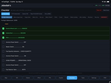
• Airspace overlays now render with class-coded boundaries — Class B blue, Class C magenta, Class D dashed blue, SUA red, matching the colors on FAA / ICAO sectionals. Fill removed so the map under- layers stay readable. • Map ruler chip is now a solid black pill, readable over VFR sectional magenta and IFR shading. • Winds aloft now auto-refresh at your ownship position and current cruise altitude every 15 minutes — required. • Checklist Read Aloud is now interruptible: tap again to stop mid-utterance. • Live CONUS radar on the Weather tab now ce position with an accurate location dot, including for pilots outside the US.
Audience growth
Ratings growth
Baseline captured. Growth appears after the crawler observes a changed rating count.
Momentum comes from crawler snapshots for the tracked storefront. “Viral growth signal” means unusually fast recent rating gains; it is an indicator, not download data.
Price tracking
Price intelligence
First snapshot captured. The trend line starts after the next crawler price observation.
- First observed Aug 16, 2026 · 2:01 AM Free
Screenshots