About this app
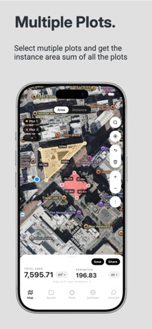
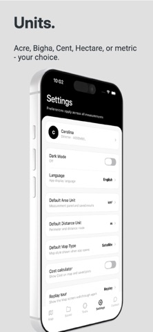
# AreaMap: Land Area Calculator Measure land, farms, fields, plots and property boundaries with GPS and interactive maps. Calculate area, perimeter and distance in seconds — directly from your iPhone or iPad. # MEASURE LAND WITH GPS Measure land accurately by placing points on the map or walking around a boundary using GPS tracking. AreaMap is useful for: • Agricultural land and farms • Fields and crop areas • Residential and commercial plots • Property boundaries • Construction sites • Gardens, parks and open spaces • Roads, paths and walking routes # POWERFUL LAND MEASUREMENT TOOLS • GPS land area measurement • Area calculator • Perimeter calculator • Distance measurement • Walk-and-measure GPS mode • Satellite and standard maps • Multiple plot measurement • Multi-zone projects • Color-coded measurement areas • Address and place search • Measurement history # MEASURE IN YOUR LOCAL UNITS Choose from a wide range of area and distance units, including: • Acre • Hectare • Square meter • Square kilometer • Square foot • Square yard • Bigha • Guntha • Cent • Ground • Meter • Kilometer • Foot • Yard • Mile # EXPORT PROFESSIONAL REPORTS Save and share your measurements with: • PDF • KML • GeoJSON Perfect for sharing measurements with property owners, clients, contractors, colleagues and project teams. # WORKS OFFLINE Continue working in locations with limited internet connectivity after maps have been loaded. Ideal for farms, rural areas, construction sites and remote locations. # COMPLETELY AD-FREE Measure without distracting advertisements, pop-ups or interruptions. # NO LOGIN REQUIRED Open AreaMap and start measuring immediately. No account or registration is required. # BUILT FOR EVERYDAY LAND MEASUREMENT Whether you are a farmer, landowner, real estate professional, contractor, engineer, architect, landscaper or simply need to measure a plot, AreaMap puts practical GPS land measurement tools on your phone. Download AreaMap and measure land, fields, plots and distances with ease.
Latest release
What’s New
This update makes measuring and reports clearer. PDF reports now show compass directions (N/S/E/W) on the plot diagram. Search is now a dedicated button on the map for quicker access. Cleaner, slimmer measurement lines and clearer mode labels. The zoom magnifier now rotates with the map when you rotate it. More accurate pricing details on the upgrade screen. App update and various bug fixes.
Audience growth
Ratings growth
Baseline captured. Growth appears after the crawler observes a changed rating count.
Momentum comes from crawler snapshots for the tracked storefront. “Viral growth signal” means unusually fast recent rating gains; it is an indicator, not download data.
Price tracking
Price intelligence
First snapshot captured. The trend line starts after the next crawler price observation.
- First observed Sep 4, 2026 · 7:44 AM Free
Screenshots