About this app
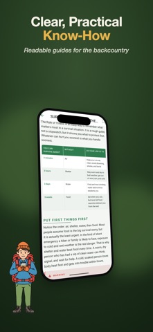
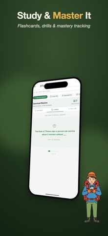
Trail Companion is your offline outdoor field companion — a complete outdoor-skills guide plus practical tools that keep working when the signal doesn't. Built for hikers, campers, scouts, and anyone getting ready for the backcountry. Everything essential works offline, on your device, with your location staying on your phone. WHAT'S INSIDE (FREE) Outdoor Skills Field Guide A full reference you can read anywhere, no connection needed: • Survival priorities and the STOP method • First aid and patient checks • Camping, shelter, and the Ten Essentials • Map and compass navigation • Building a fire safely • Finding, treating, and purifying water • Knots, weather, and Leave No Trace ethics Clear chapters with quick shortcuts to the skills you reach for most. Badge Prep Track requirements, check off skills, and jump into the matching guide sections (names are for reference only — not affiliated with any scouting organization). Offline Navigation A compass, your position, and straight-line bearings back to your start, saved waypoints, and the nearest town — no signal needed. Record a breadcrumb track and follow "back to start" to retrace your steps. Identify What You Find • Cloud ID — point your camera at the sky to name the cloud and read the weather it brings • Rock & Mineral ID — answer a few quick property questions to identify a rock or mineral • Edible & Dangerous Insects — a field reference to which bugs are safe and which to avoid ONE-TIME UNLOCK (PRO) Unlock every advanced tool with a single purchase — no subscription, no recurring charge: On-Device Photo ID Photograph a plant, insect, fungus, lichen, or animal and identify it right on your device — fully offline, with edibility and toxicity notes and deadly look-alike warnings. Study Guide Flashcards, fill-in-the-blank drills, and mastery tracking to lock in your outdoor knowledge. Field Intel Location-aware intelligence for wherever you are — species recorded near you right now plus live weather, and curated edible plants, hazards, and dangerous wildlife for your region. Wildlife Map See animals, birds, and plants recently observed near you, from community observation data. Full Offline Navigation Add the offline map view and the complete "nearest of" set — bearings to the closest water, rivers, trails, roads, and high ground — powered by downloadable offline map packs. In-App Search & Bookmarks Search the entire guide instantly and save the sections you want to find fast. PRIVACY Your location powers navigation and nearby intel — it stays on your device and is never uploaded. Photo identification runs entirely on your phone. IMPORTANT Bearings are straight-line, not a safe walking route — terrain, cliffs, and water may block a direct path. Always carry a real map and compass as backup. This app is an outdoor-skills reference for training and preparation, not a substitute for professional instruction or emergency services. Get ready for the trail. Download Trail Companion and head out prepared.
Latest release
What’s New
New Signaling tools add an SOS beacon that uses your flashlight and screen, plus a terrain aware cell signal finder that points you toward the nearest place likely to have coverage. Offline maps are more reliable, you can name and manage waypoints, and coverage estimates now account for terrain.
Audience growth
Ratings growth
Baseline captured. Growth appears after the crawler observes a changed rating count.
Momentum comes from crawler snapshots for the tracked storefront. “Viral growth signal” means unusually fast recent rating gains; it is an indicator, not download data.
Price tracking
Price intelligence
First snapshot captured. The trend line starts after the next crawler price observation.
- First observed Aug 15, 2026 · 4:55 PM Free
Screenshots