About this app
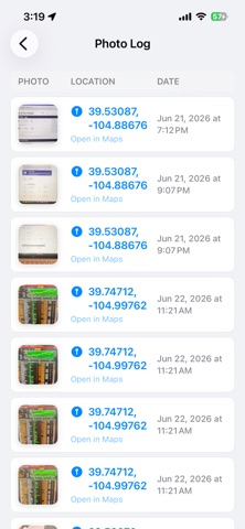
Photo Maper is a private iPhone and iPad app that turns the GPS metadata in selected photos into an interactive travel map. Users can import photos from their library, view each photo’s location as a marker on Apple Maps, and see a chronological route line connecting the places they visited. The app works locally on device, supports multiple map styles, summarizes route distance, and saves mapped trips so users can revisit their photo-based travel history without uploading their images or location data.
Audience growth
Ratings growth
Baseline captured. Growth appears after the crawler observes a changed rating count.
Momentum comes from crawler snapshots for the tracked storefront. “Viral growth signal” means unusually fast recent rating gains; it is an indicator, not download data.
Price tracking
Price intelligence
First snapshot captured. The trend line starts after the next crawler price observation.
- First observed Sep 4, 2026 · 6:14 AM Free
Screenshots