About this app
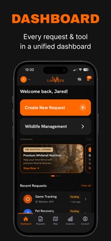
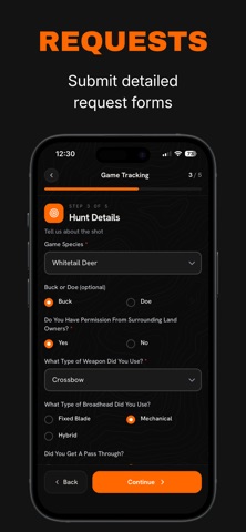
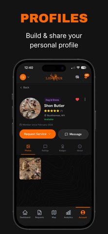
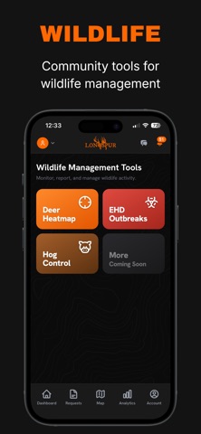
Longspur is a hunting and wildlife management platform. It connects hunters with certified tracking dog handlers and thermal drone pilots for game recovery, and other wildlife management tools. WHEN THE CLOCK IS RUNNING A shot that doesn't go the way you planned starts a countdown. Longspur puts your request in front of nearby handlers and drone pilots in minutes, instead of an hour spent calling around for a number that still works. 1. Submit a request. Drop your GPS coordinates, mark the shot placement, and add what matters: distance, angle, animal, evidence found, and how long you've waited. 2. Nearby trackers are notified immediately by push and text. 3. A tracker accepts, and their phone number and email appear in your request. Call them directly and coordinate the recovery. 4. Log the outcome so the result is on record. WILDLIFE MANAGEMENT TOOLS - Whitetail recovery heatmap, filterable by season, so you can see where activity is concentrated - EHD outbreak map for hemorrhagic disease reports in your region - Feral hog activity map showing reported pressure nearby - Submit your own EHD and feral hog observations straight from the field Reports feed the public maps with their coordinates deliberately offset, so you can contribute what you saw without publishing exactly where you were. FOR HUNTERS - Guided request form with a shot placement selector and evidence photos - Exact GPS coordinates, so a tracker can navigate straight to you - Real-time status updates from request through recovery - In-app messaging with the tracker who accepted - Your recovery stats: request volume, outcomes, and recovery rate over time FOR TRACKING DOG HANDLERS AND DRONE PILOTS - See requests in your service area with the full detail before you commit - Accept in one tap and get the hunter's contact information - A public profile with your experience, certifications, dogs, and coverage area - Analytics on accepted work, recovery rate, and response time - Log external tracks, so a whole season lives in one place PET RECOVERY The same network of handlers and drone pilots, for a lost dog or cat. WHAT IT COSTS Creating an account and submitting requests is free. Trackers set their own rates, which you agree and pay directly with them. Longspur does not process payments and takes no cut. A VETTED NETWORK Every tracker completes an application covering experience, certifications, and service area, and is reviewed by our team before they can accept a request. Certifications are self-reported. PRIVACY Your hunt location is visible only to trackers viewing or accepting your request. Location is read only while the app is open, never in the background. Public wildlife maps never show exact coordinates. We do not sell your data. Longspur is available in the United States.
Latest release
What’s New
• Confirming your email and resetting your password is now faster. Just enter the 6-digit code we send you, right inside the app.
Audience growth
Ratings growth
Baseline captured. Growth appears after the crawler observes a changed rating count.
Momentum comes from crawler snapshots for the tracked storefront. “Viral growth signal” means unusually fast recent rating gains; it is an indicator, not download data.
Price tracking
Price intelligence
First snapshot captured. The trend line starts after the next crawler price observation.
- First observed Sep 4, 2026 · 7:10 AM Free
Screenshots