About this app
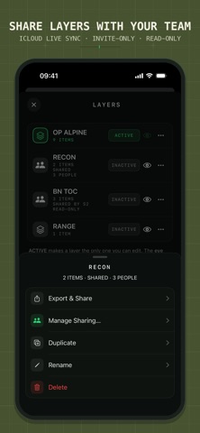
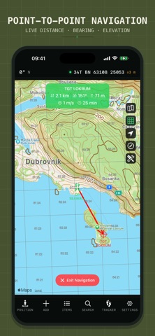
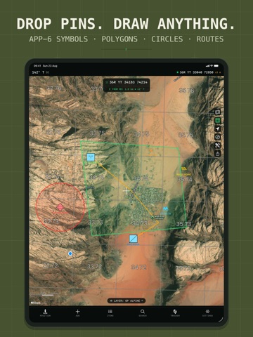
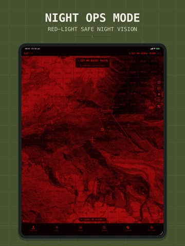
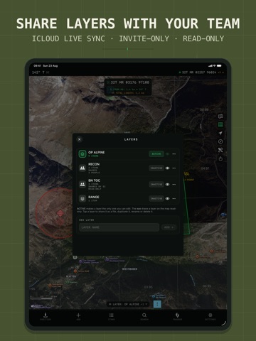
Tactical GPS is the Swiss Army knife of navigation - everything you need in one app. Plan routes, navigate cross-country, record tracks, analyze terrain and share your map with your team - online or fully offline, with the precision of a purpose-built instrument. Made for soldiers, SAR teams, hikers, hunters and anyone who reads maps. Designed and built natively for iPhone and iPad. No cross-platform compromises. Just a fast, precise tactical navigation experience. SHARE & SYNC - NEW • Share a map layer with your team over iCloud: everyone sees pins, routes and shapes update live - photos, voice memos and PDF attachments included. Invite-only, no accounts, no exporting. • Connect to a TAK server to exchange position and data in real time, with built-in certificate enrollment • Export your work as GPX, KML/KMZ, GeoJSON, CSV or DXF and continue in any other tool PLAN, NAVIGATE, TRACK • Plan routes and areas directly on the map, online or offline • Generate routes with elevation profiles • Navigate point-to-point or along a route - live distance, bearing, ETA, back azimuth and elevation delta • Record tracks with pause, auto-pause and a Live Activity on your Lock Screen • Set up geofences and location alerts • Organize everything in layers - keep missions, trips and training areas separate MAPS, ONLINE OR OFFLINE • Download map regions for fully offline use • Live topographic contour lines and hillshading • MGRS, UTM or Lat/Lon grid overlay on every basemap • Overlays for trails, cycling, ski slopes and sea marks • Night-vision mode: red or green monochrome display across the entire app FIELD & TERRAIN TOOLS • Viewshed and line-of-sight analysis • Range rings, bearings and point projections • Distance and area measurement • NATO (APP-6) map symbols • Elevation and depth readings anywhere on the map • On-position weather forecasts PRECISION POSITIONING • MGRS / UTM / USNG / Lat-Lon, plus national grids: British, Irish, Swedish, Finnish, New Zealand and more • Dozens of map datums with proper transformations • True, magnetic or grid north reference • Connect an external Bluetooth GNSS receiver for higher-precision positioning • Import GPX, KML/KMZ, GeoJSON, GeoPackage, Shapefile, CSV and more PERFECT FOR • Land navigation and route planning • Hiking, cycling and off-road exploration • SAR and field operations • Outdoor training and navigation exercises Note: Route navigation, additional maps, unlimited overlays and layers, special tools, tracking, iCloud layer sharing and export features require a PRO upgrade.
Latest release
What’s New
- COORDINATE SYSTEMS: Use any EPSG code, add a secondary readout, save favourites, plus UTM options and quadrant bearings - SMART COORDINATE ENTRY: Paste a position in any supported format and the app recognises it - BACK BEARING & GEOFENCE TONES: See the reverse azimuth and get audible alerts when approaching a geofence - OVERLAY STACK: Overlay several map overlays at once with per-overlay opacity and colour adjustments - OFFLINE MAPS: Download size estimate, extra layers inside packs and one-tap refresh - MAP PRESETS: Save your map setups and lock the screen against accidental touches - EXTERNAL RECEIVERS: Antenna height correction, plus a bubble level on the compass - TRACK RECORDER: Activity types, laps, automatic recording interval, richer stats, an interactive elevation profile and CSV export - CUSTOM PIN ICONS: Use your own icons for map items - ORGANIZATION: Nested folders, item sorting, move-to-layer, merge paths, folder import and KMZ photo size options - QUICK ACTIONS: Chips for common tasks, map long-press menu, Siri App Shortcuts and geo: link support - BACKUP & RESTORE: Export everything to a single .tgpsbackup file and restore it on any device - MORE LANGUAGES - bug fixes and improvements
Audience growth
Ratings growth
Baseline captured. Growth appears after the crawler observes a changed rating count.
Momentum comes from crawler snapshots for the tracked storefront. “Viral growth signal” means unusually fast recent rating gains; it is an indicator, not download data.
Price tracking
Price intelligence
First snapshot captured. The trend line starts after the next crawler price observation.
- First observed Sep 18, 2026 · 2:26 AM Free
Screenshots