About this app
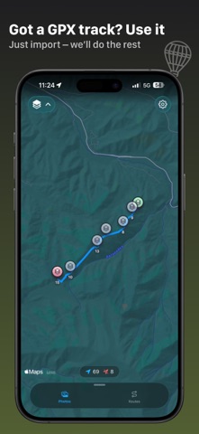
FollowPhoto — recreate your routes and geotag your photos with ease. You were out exploring, snapping photos on your camera, but forgot to turn on your GPS tracker? Or maybe you saved battery on purpose to avoid being left without signal? FollowPhoto helps you reconstruct your journey even when the tracker was off. Just select a few geotagged photos (for example, taken on your phone), and FollowPhoto will rebuild your approximate route. You can then automatically assign coordinates to the rest of your photos — even if they were taken on a camera without GPS. What FollowPhoto can do: - Reconstruct a route using just a few geotagged photos - Add GPS coordinates to photos without location data - Import and export routes in standard GPX format - Seamless integration with iCloud Photo Library — no need to import manually - View distance, elevation, timestamps, and waypoints Perfect for travelers, photographers, and anyone who wants to keep a clean, accurate map of their memories. FollowPhoto turns your photos into a story on the map — simply and reliably. Route rebuilding function will generate an approximate route based on selected photos and other factors, and cannot return 100% accurate route Examples of use: https://quasar-sprite-2a0.notion.site/Examples-of-use-1c7799f1b2ba80d9918fe707e2b80247 Privacy Policy: https://followphoto.github.io/privacy-policy.html Terms Of Use: https://followphoto.github.io/terms-of-use.html
Audience growth
Ratings growth
Baseline captured. Growth appears after the crawler observes a changed rating count.
Momentum comes from crawler snapshots for the tracked storefront. “Viral growth signal” means unusually fast recent rating gains; it is an indicator, not download data.
Price tracking
Price intelligence
First snapshot captured. The trend line starts after the next crawler price observation.
- First observed Aug 31, 2026 · 6:09 AM Free
Screenshots