About this app
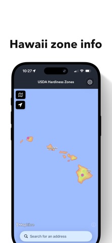
Every thriving garden begins with climate awareness. This app brings the official United States Department of Agriculture Plant Hardiness Zones into a living, interactive map — so you can explore growing conditions anywhere in the United States. Tap any location on the map to instantly reveal: * The official USDA hardiness zone * Nearby weather stations with frost tables No guesswork. No generic region estimates. Just exact coordinates. ===================================== Interactive USDA Hardiness Zone Map ===================================== Explore official zone shapefiles provided by Oregon State University and view the most current USDA classifications in a seamless, touch-responsive map. Whether you're: * Planning a vegetable garden * Choosing perennials * Researching fruit trees * Evaluating property for homesteading * Designing a landscape You can verify growing zones instantly — anywhere in the U.S. ===================================== Frost Dates & Weather Station Data ===================================== Tap a weather station to access historical frost tables provided by National Oceanic and Atmospheric Administration. View: * First and last frost dates * Freeze probabilities * Station-specific climate data * Hardiness zone for that station’s coordinates Because planting decisions should be grounded in real climate history.
Audience growth
Ratings growth
Baseline captured. Growth appears after the crawler observes a changed rating count.
Momentum comes from crawler snapshots for the tracked storefront. “Viral growth signal” means unusually fast recent rating gains; it is an indicator, not download data.
Price tracking
Price intelligence
First snapshot captured. The trend line starts after the next crawler price observation.
- First observed Aug 7, 2026 · 9:17 PM Free
Screenshots