About this app
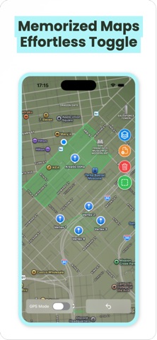
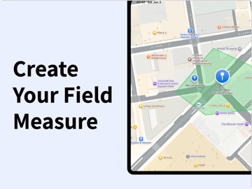
Geo Land Measure – Your Professional GPS Field Assistant Measure Land Area, Distance & Perimeter with Pinpoint Accuracy Geo Land Measure transforms your iPhone into a powerful surveying tool. Leverage your phone‘s GPS to measure land area, calculate perimeter, and mark distances with outstanding accuracy — replacing expensive, specialized equipment. Core Features for Field Work: • Fast & Accurate Measurement: Draw shapes directly on the map or walk boundaries with GPS tracking. • Full Data Management: Save, name, and organize all your projects (measurements) locally. • Map & Satellite Views: Switch between standard and hybrid maps for optimal clarity. What’s New & Improved: • Account & Personalization: Log in to unlock a tailored experience and prepare for future cloud features. • Quick-Access Side Menu: Tap the top-left menu icon for instant access to all core tools. • One-Tap Save: Never lose data. Save your drawings and measurement details instantly. • In-App Feedback Channel: Found a bug? Have a great idea? Talk to us directly from within the app. Perfect For: • Farmers & Agronomists calculating field size for planting or irrigation. • Surveyors, Engineers & Construction Pros for quick on-site marking and validation. • Real Estate Agents & Property Owners verifying plot dimensions and boundaries. • Outdoor Enthusiasts & Gardeners planning projects or mapping trails. Why Choose Geo Land Measure? It‘s simple enough for anyone to use, yet powerful enough for professional tasks. Get reliable measurements, intuitive drawing tools, and now, a more connected workflow — all in one cost-effective app. Download Now and Measure Your World with Confidence. Privacy Policy: https://areameasure.top/privacy.html Terms of Use: https://areameasure.top/terms.html
Latest release
What’s New
- Camera Support: Take photos directly during field logging to capture site conditions - Borehole Editing: Edit drill holes within your surveyed area - Area Split: Divide existing polygons into multiple independent zones
Audience growth
Ratings growth
Baseline captured. Growth appears after the crawler observes a changed rating count.
Momentum comes from crawler snapshots for the tracked storefront. “Viral growth signal” means unusually fast recent rating gains; it is an indicator, not download data.
Price tracking
Price intelligence
First snapshot captured. The trend line starts after the next crawler price observation.
- First observed Aug 20, 2026 · 1:28 AM Free
Screenshots