About this app
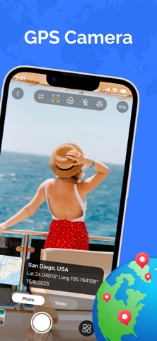
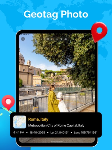
GPS Map: Timestamp Camera – The ultimate geotagging camera for capturing every place and moment. Make every photo truly memorable with GPS Map: Timestamp Camera – the powerful app that automatically adds GPS location, timestamp, and map info to your pictures. Whether you’re traveling, working outdoors, or documenting daily life, GPS camera helps you capture every shot with precise location details. Capture Every Memory with GPS camera This professional geo-tagging camera uses smart GPS technology to automatically embed coordinates, time automatically, and map details into each image – helping you preserve and relive your adventures exactly where they happened. Key Features ● Smart GPS Geotagging – Instantly capture map photos with precise latitude, longitude, address, and time. ● Automatic Timestamp & Location – Add real-time date, time, and GPS info to every photo effortlessly. ● Stylish Filters – Enhance your images with beautiful filters. ● Photo Manager – View, organize, and manage all your geotagged photos easily in My Files. ● Various Templates – Choose from multiple display styles for map and timestamp overlays. Download GPS Map: Timestamp Camera today and transform the way you capture and share your world. Every shot tells a story – make yours stand out with accurate GPS map tagging. Thank you for using GPS Map: Timestamp Camera! If you enjoy the app, please leave a review – your feedback helps us make app even better for your next adventure.
Latest release
What’s New
- New version 1.0.1 - Overall performance improved
Audience growth
Ratings growth
Baseline captured. Growth appears after the crawler observes a changed rating count.
Momentum comes from crawler snapshots for the tracked storefront. “Viral growth signal” means unusually fast recent rating gains; it is an indicator, not download data.
Price tracking
Price intelligence
First snapshot captured. The trend line starts after the next crawler price observation.
- First observed Aug 21, 2026 · 2:42 PM Free
Screenshots