About this app
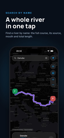
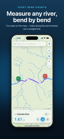
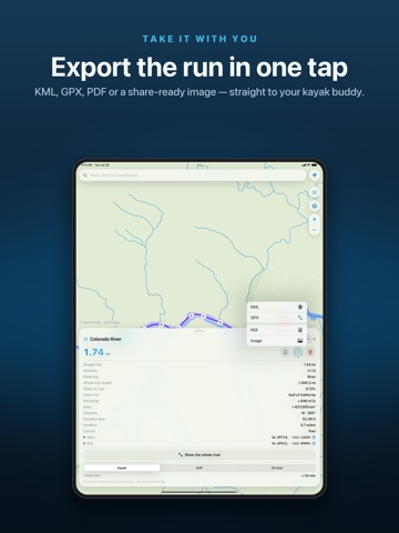
How long is that stretch of river you are about to paddle? Drop two pins and River Ruler measures the riverbed itself, following every bend instead of drawing a straight line. You also get the numbers that decide a trip: where the river starts and ends, how much water it carries, how steep it runs, how winding it is, and how long the section takes by kayak, SUP or on foot. • Measure any river section — along the real riverbed, not a straight line • See the whole river, from source to mouth, with its total length • Find rivers by name, or jump straight to coordinates • Sinuosity, gradient, elevation drop, discharge, basin area, flow direction • Travel time for kayak, SUP or walking • Export as GPX for your GPS, KML for Google Earth, PDF or a ready-to-send image • Saved log of your measurements • Light and dark map styles Built on open OpenStreetMap data. No account, no sign-up, no ads. Terms of Use (EULA): https://www.apple.com/legal/internet-services/itunes/dev/stdeula/ Privacy Policy: https://docs.google.com/document/d/1yTks6ZXW39TOUheZfEf96e-T1cFWzF1eWik8Ax-9HAo/edit?tab=t.0
Latest release
What’s New
bug fixes, new features
Audience growth
Ratings growth
Baseline captured. Growth appears after the crawler observes a changed rating count.
Momentum comes from crawler snapshots for the tracked storefront. “Viral growth signal” means unusually fast recent rating gains; it is an indicator, not download data.
Price tracking
Price intelligence
First snapshot captured. The trend line starts after the next crawler price observation.
- First observed Aug 20, 2026 · 10:56 PM Free
Screenshots