About this app
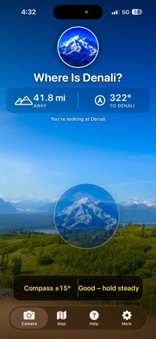
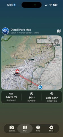
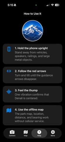
Find Denali--even when you can't see it. Every year, thousands of visitors come to Denali National Park hoping to see North America's highest peak. Unfortunately, clouds often hide it completely. Where's Denali? uses your iPhone's GPS, compass, and motion sensors to show exactly where Denali is located. Simply point your phone at the landscape and the mountain appears in its proper position on the live camera view. Features +Live camera overlay +Works without cellular service +Offline park map +Distance and compass bearing +Visual guidance arrows +Haptic confirmation when centered +Accurate mountain positioning +No ads +No account required +Privacy friendly Perfect for: +Park visitors +Road travelers +Hikers +Photographers +Tour Guides Designed Specifically for Denali National Park --by Alaskans The app was built to help visitors answer the most common question in the park: "Where is Denali?"
Audience growth
Ratings growth
Baseline captured. Growth appears after the crawler observes a changed rating count.
Momentum comes from crawler snapshots for the tracked storefront. “Viral growth signal” means unusually fast recent rating gains; it is an indicator, not download data.
Price tracking
Price intelligence
First snapshot captured. The trend line starts after the next crawler price observation.
- First observed Aug 21, 2026 · 4:33 AM Free
Screenshots