About this app
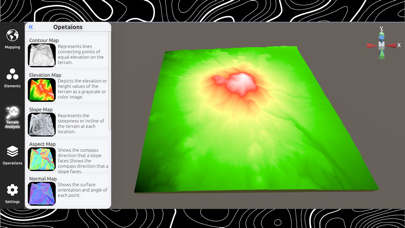
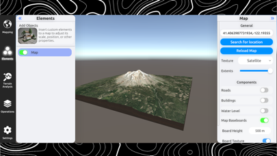
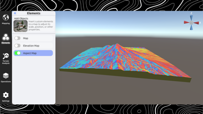
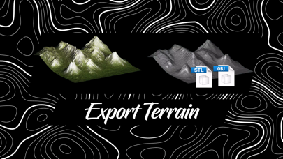
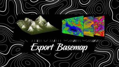
3D Mappa revolutionizes the world of GIS for mobile. Designed for professionals and enthusiasts alike, our app puts a powerful suite of terrain analysis tools in the palm of your hand, making complex geospatial tasks effortless and instantaneous. Export data in seconds to industry-standard formats like DXF, SHP, GeoJSON, KML, OBJ, glTIF, and STL, ensuring compatibility with AutoCAD, and GIS software. From surveyors and land managers to outdoor enthusiasts, 3D Mappa allows you to visualize land features with unparalleled precision. Instantly generate elevation models, analyze slopes, and automate site audits using integrated AI. Say goodbye to cumbersome desktop software and hello to streamlined, mobile-first GIS. INTELLIGENT TERRAIN ANALYSIS Visualize your terrain through 10+ dynamic analytical lenses. Toggle between high-precision maps to reveal hidden characteristics of any landscape: - Contour Maps: View precise elevation intervals with connecting lines. - Elevation Heatmaps: Depict height variations through rich color gradients. Slope & Aspect: Instantly calculate the steepness and facing direction of any surface. - Normal & Landform Maps: Analyze surface orientation and detailed geographic features. - Flow & Curvature: Visualize water drainage patterns and terrain curvature for hydrological assessment. - Residual Analysis: Highlight baseline deviations for advanced geological studies. - Cross-Sectioning: Generate 2D plots to visualize elevation profiles along any path. PRO-GRADE MODELING & IMPORT Data Server Integration: Create high-resolution Digital Elevation Models (DEMs) directly from Google Maps and Mapbox servers. Custom Imports from cloud points (XYZ/CSV) or LiDAR (LAS/LAZ): Bring your own point clouds to life. Using advanced Delaunay triangulation, 3D Mappa transforms raw coordinates into accurate, interactive 3D models. Live AI Site Audits: Enhance your workflow with GIS-grounded AI. Automatically generate insights for land ownership, flood risks, soil data, and more based on your exact location. INDUSTRY-STANDARD EXPORTS Move your data from your device to the office in seconds. 3D Mappa supports high-fidelity exports ensuring seamless compatibility with AutoCAD, ArcGIS, and other professional platforms: CAD & Modeling: DXF, STL, glTF, OBJ GIS Formats: SHP, GeoJSON, KML High-Resolution Output: CSV data and textures up to 8K resolution. BUILT FOR SPEED & EFFICIENCY Real-Time Calculations: Calculate Area and Volume on the fly. Location History: Access your past projects and locations with a single tap. Cloud Persistence: (Infinite Tier) Securely sync your data and project history across devices. Experience the future of mobile GIS. Terms of Use: https://www.apple.com/legal/internet-services/itunes/dev/stdeula/
Latest release
What’s New
- Integrated AI Auditor: Unlock instant, GIS-grounded insights for land ownership, flood risks, soil data, and more using our new AI-driven site audits. - LiDAR Power: Now supports importing and visualizing high-precision LAZ and LAS point cloud files directly in 3D. - Advanced Exports: Expanded compatibility with new GeoJSON and KML file exports for seamless integration with Google Earth and GIS software. - Performance Engine: Dramatically faster 3D model generation and improved mesh quality for complex terrains. - Cloud Persistence: Securely sync your data, project history, and personal settings across all your devices and platforms. - 30-Day Free Trial: Experience the full potential of 3D Mappa with our updated subscription system—start your professional journey with a month of full access on us!
Audience growth
Ratings growth
Baseline captured. Growth appears after the crawler observes a changed rating count.
Momentum comes from crawler snapshots for the tracked storefront. “Viral growth signal” means unusually fast recent rating gains; it is an indicator, not download data.
Price tracking
Price intelligence
First snapshot captured. The trend line starts after the next crawler price observation.
- First observed Aug 10, 2026 · 3:19 AM Free
Screenshots